

The Earth’s crust is the outermost layer of our planet, composed of a variety of rocks and minerals. It is relatively thin compared to the layers beneath it, such as the mantle and core. Understanding the structure of the Earth’s crust is essential for studying geological processes, natural resources, and tectonic activity.
This diagram illustrates the different components of the Earth’s crust, including continental and oceanic crust, as well as the various rock types found within these layers.
Understanding the Earth’s Crust
The Earth’s crust serves as the planet’s outermost layer, encompassing a complex structure that is vital to our understanding of geological processes.
It consists of two primary types: continental crust and oceanic crust.
Continental crust forms the landmasses we inhabit, while oceanic crust lies beneath the oceans, each exhibiting distinct characteristics.
Thickness varies significantly between these two types, with continental crust averaging around 30 kilometers, whereas oceanic crust measures about 5 to 10 kilometers in thickness.
This variation plays a crucial role in the dynamics of tectonic plates and the geological features we observe on the surface.
Components of the Earth’s Crust
The diagram highlights several key components of the Earth’s crust.
Continental crust is generally thicker and less dense, primarily composed of granitic rocks, which contribute to its buoyancy.
In contrast, oceanic crust is thinner and denser, mainly made up of basaltic rocks, which allows it to sit lower in the mantle.
Understanding these components is essential for comprehending how they interact with the underlying layers of the Earth.
The differences in composition and thickness between the two types of crust influence various geological phenomena, including earthquakes and volcanic activity.
The Lithosphere and Asthenosphere
Another important aspect depicted in the diagram is the lithosphere and asthenosphere.
The lithosphere encompasses the rigid outer layer of the Earth, which includes both the crust and the uppermost part of the mantle.
This layer is crucial for tectonic activity, as it is divided into tectonic plates that float on the semi-fluid asthenosphere beneath.
The asthenosphere, located just below the lithosphere, is characterized by its semi-fluid properties, allowing for the movement of tectonic plates.
This movement is responsible for many geological processes, including the formation of mountains, earthquakes, and oceanic ridges.
Visual Representation of Earth’s Layers
The diagram provides a cross-sectional view of the Earth, emphasizing the position of the crust relative to the mantle and core.
This visual representation helps to clarify the relationships between the different layers of the Earth and their respective roles in geological processes.
By illustrating the various layers, the diagram serves as an educational tool for understanding the Earth’s structure and the dynamics at play beneath our feet.
It highlights the importance of the crust in relation to the mantle and core, showcasing how these layers interact with one another.
Importance of Studying the Earth’s Crust
Studying the Earth’s crust is essential for various scientific fields, including geology, environmental science, and natural resource management.
Understanding the composition and structure of the crust allows scientists to better predict geological events and assess natural resources.
Furthermore, knowledge of the crust’s characteristics aids in the exploration of minerals and fossil fuels, which are crucial for energy production and economic development.
By examining the crust, researchers can gain insights into the history of our planet and the processes that have shaped its surface over millions of years.
Conclusion
The detailed diagram of the Earth’s crust serves as an invaluable resource for understanding the complexities of our planet’s outer layer.
By showcasing the differences between continental and oceanic crust, as well as the lithosphere and asthenosphere, it provides a clear visual representation of Earth’s structure.
This knowledge is fundamental for advancing our understanding of geological processes and the natural world.
Understanding the Earth’s Crust
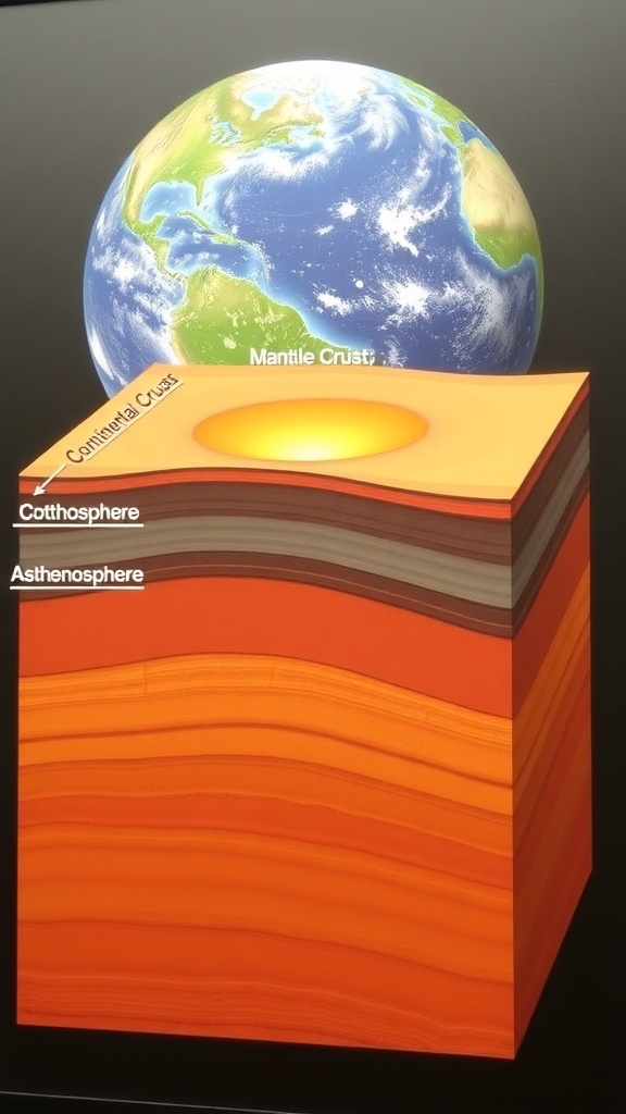
The Earth’s crust is divided into two main types: continental crust, which forms the continents, and oceanic crust, which underlies the oceans. The crust varies in thickness, with continental crust averaging about 30 kilometers and oceanic crust around 5-10 kilometers. This diagram provides a visual representation of these layers and their characteristics.